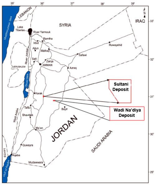
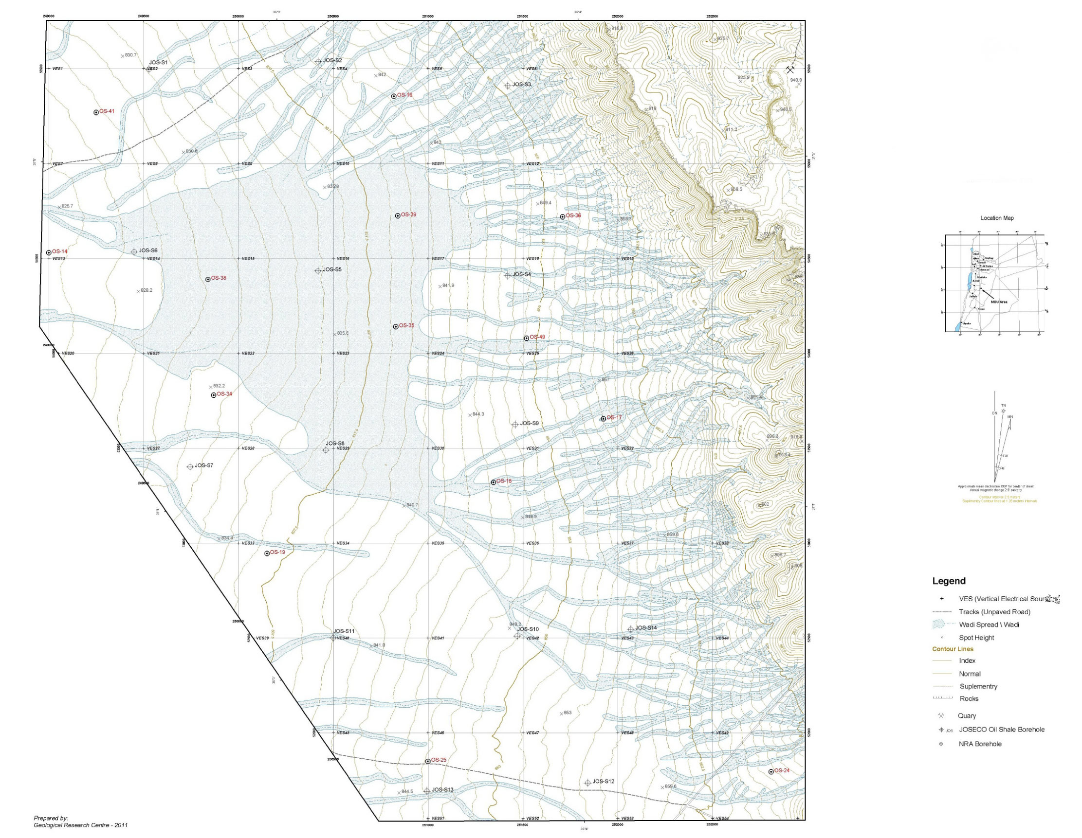
A detailed exploration programme of oil shale deposits was conducted on the concession area of Sultani in central Jordan. The programme consisted of topographic surveying, detailed geological mapping, and geophysical investigations in terms of vertical electrical sounding of 55 VES points as well as geophysical well logging to some wells. Intensive hydrological and hydrogeological studies were also conducted. The programme included drilling 14 boreholes with a total depth of 1640 m followed by systematic sampling and assaying of representative oil shale sampling. A total of 357 samples were analyzed at the laboratories of the Natural Resources Authority (NRA). The exploration and the assaying data were then integrated in several evaluation processes including ore reserve calculation, mine planning, and cost analysis. A comprehensive environmental impact assessment (EIA) was also conducted.
The exploration programme indicated that the average thickness of oil shale in the Sultani area is about 31 m. The cut-off grade (COG) was set at 900 kcal of oil shale/kg. The total volume of high COG oil shale is about 270 million m3, which is equivalent to about 498 million tonnes and the average oil yield in the vast majority (over 80%) of test boreholes was higher than 10% which defines it as high-quality oil shale suitable for commercial exploitation.
The mine life is estimated to be about 30 years based on ore production rate. The mining capital costs and opening costs have been also estimated throughout the project life.
Focus Areas
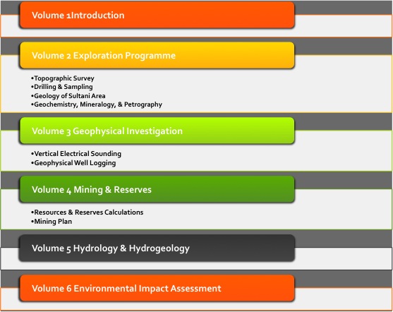
The Exploration Programme studied the following major areas: topographic survey, drilling and sampling, geochemistry, mineralogy, petrography studies, vertical electrical sounding, geophysical well logging, resources & reserves calculations, mining plan, hydrology and hydrogeology as well as an Environmental Impact Assessment (EIA). The Explorations Programme results were reported in six volumes:
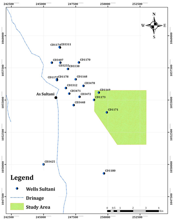
Map indicating the location of the Sultani Area
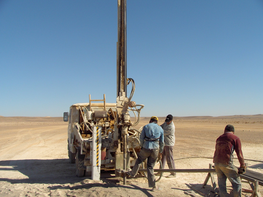
Exploration Programme – Topographic Survey
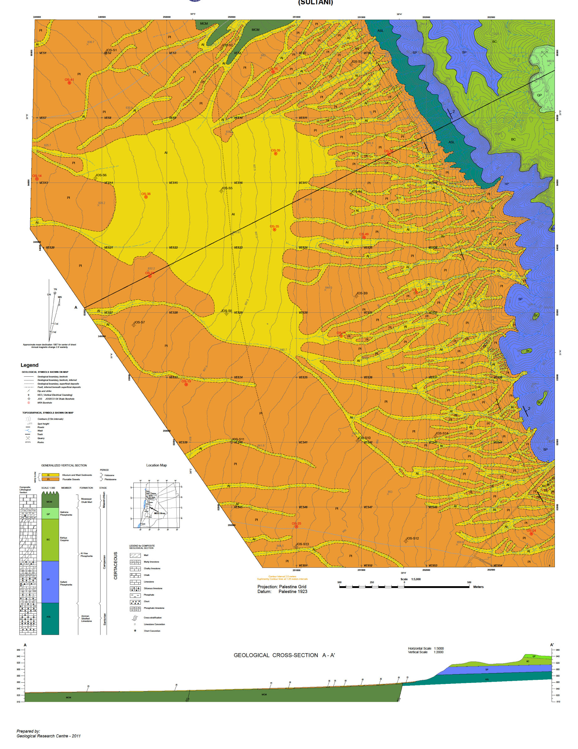
Exploration Programme – Geology of Sultani Area
Bituminous marl is overlain by barren rock (overburden) of cretaceous, tertiary and quaternary formations. The types of rocks present are limestone, phosphates, chalk marl, cherts, basalts, wadi and mud flat sediments of Campanian Maestrichtian, Paleocene, and Holocene ages. The calcareous bituminous marl (oil shale) of Sultani is generally grey, grey brown, and brown. It is thin-bedded and laminated and has a distinct bituminous smell, phosphatic material is always present.
Geological Map of the Sultani Area
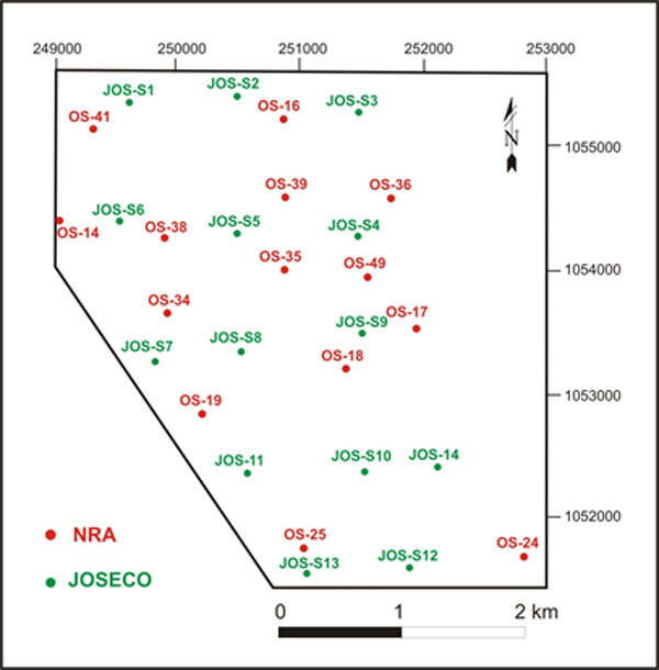
A map indicating the overlap of Shale Energy boreholes and NRA boreholes of previous studies
Average oil yield in the eleven out of fourteen boreholes was higher than 10%, which ranks it at high-quality oil shale, feasible to exploit.
Fisher Assay Analysis – Oil Content
The oil yields of low-temperature carbonization process (Fischer Assay) are oil, water, gas, and residue (spent shale). Oil content is one of the main parameters that determine the suitability of the oil shale deposit to be used as a source of oil production by retorting.
The analysis was carried out using the Fisher Assay apparatuses in NRA laboratory. The aluminum cast retort, where the oil shale was pyrolysed up to 520° C and the amounts of water, oil, gas, and residue (spent shale) were recorded by balance from raw oil shale. The oil yield of the samples and in the borehole, in general, is a major parameter, which determined the quality of the deposit and showed that the average oil yield in the eleven boreholes is higher than 10%.
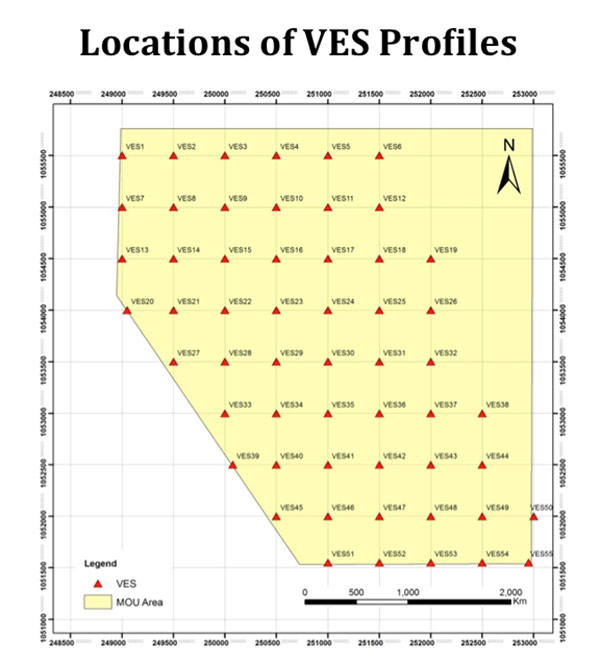
Geophysical Investigation – Vertical Electrical Sounding
Hydrology & Hydrogeology